 |
usa | world | animals | vocabulary | health | science | math | history |
The Andes Mountains
The Andes is a vast mountain system forming a continuous chain of highland along the western coast of South America. It is roughly 7000 km (4400 mi) long, 500 km (300 mi) wide in some parts (widest between 18° to 20° S latitude), and of an average height of about 4000 m (13,000 ft).
The connection of this system with that of the Rocky Mountains, which has been pointed out by many writers, has received much support from the discovery of the extensive eruptions of granite during Tertiary times, extending from the southern extremity of South America to Alaska.

Andes Mountains from Bogata, Columbia
The Andean range is composed of two great principal chains with a deep intermediate depression, in which, and at the sides of the great chains, arise other chains of minor importance, the chief of which is that called the Cordillera de la Costa of Chile. This starts from the southern extremity of the continent and runs in a northerly direction, parallel with the coast, being broken up at its beginning into a number of islands and afterwards forming the western boundary of the great central valley of Chile. To the north this coastal chain continues in small ridges or isolated hills along the Pacific Ocean as far as Colombia, always leaving the same valley more or less visible to the west of the western great chain.

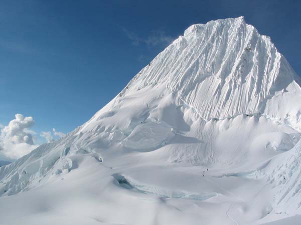
Alpamayo in the Peruvian Andes
Of the two principal chains the eastern is generally called Los Andes, and the western La Cordillera, in Colombia, Peru and Bolivia, where the eastern is likewise known as Cordillera Real de los Andes, while to the south of parallel 23°S in Chile and Argentina, the western is called Cordillera de los Andes. The eastern disappears in the centre of Argentina, and it is therefore only the Cordillera de los Andes that is prolonged as far as the south-eastern extremity of the continent.

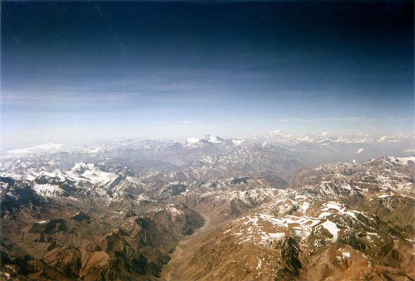
Andes Mountains between Chile and Argentina
The Cordillera de la Costa begins near Cape Horn, which is composed principally of crystalline rocks, and its heights are inconsiderable when compared with those of the true Cordillera of the Andes. The latter, as regards its main chain, is on the northern coast of the Beagle Channel in Tierra del Fuego, bounded on the north by the deep depression of Lake Fagnano and of Admiralty Sound. Staten Island appears to be the termination to the east. The Cordillera of the Andes in Tierra del Fuego is formed of crystalline schists, and culminates in the snow-capped peaks of Mount Darwin and Mount Sarmiento 2200 m(7200 ft), which contains glaciers of greater extent than those of Mont Blanc. The extent of the glaciers is considerable in this region, which, geographically, is more complex than was formerly supposed. Although in the explored portion of the Fuegian chain the volcanoes which have been mentioned from time to time have not been met with, the islands to the south hold many neo-volcanic rocks, some of which appear to be contemporaneous with the basaltic sheet that covers a part of eastern Patagonia. The insular region between Mount Sarmiento and the Cordillera de los Andes, properly so called, i.e. that which extends from Magellan Strait northwards, is not fully explored, and all that is known of it is that it is principally composed of the same rocks as the Fuegian section, and that the greater part of its upper valleys is occupied by glaciers that reach down to the sea amid dense forest.
This article is licensed under the GNU Free Documentation License. It uses material from the Wikipedia article "Andes".