|
Northwest Territories
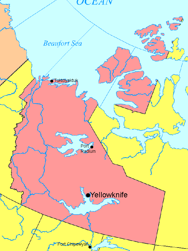
One of the territories of Arctic Canada, the Northwest Territories (NWT; French, les Territoires du Nord-Ouest) has a landmass of 1,171,918 square kilometres and a population of 42,944 as of the January 1, 2005. Its capital has been Yellowknife since 1967; see also List of communities in the Northwest Territories. The Northwest Territories are located east of Yukon, west of Nunavut, and north of British Columbia, Alberta, and Saskatchewan. Geographical features include the vast Great Bear and Great Slave Lakes, as well as the immense Mackenzie River and the canyons of the Nahanni River, a national park and UNESCO World Heritage Site. In the Arctic Archipelago, the Northwest Territories includes Banks Island, Parry Peninsula, Prince Patrick Island, and parts of Victoria Island and Melville Island. The highest point is Mount Nirvana near the border with Yukon at elevation 2773 m (9098 ft). The Northwest Territories were created in 1870, when the Hudson's Bay Company transferred Rupert's Land and the North-Western Territory to the government of Canada. These formed the Northwest Territories. This immense region comprised all of modern Canada except British Columbia, the coast of the Great Lakes, the Saint Lawrence River valley and the southern third of Quebec, the Maritimes, Newfoundland, and the Labrador coast. It also excluded the Arctic Islands except the southern half of Baffin Island; these remained under direct British rule until 1880. After the transfer, the Territories were gradually whittled away. The province of Manitoba was created in 1870, a tiny square around Winnipeg, and then enlarged in 1881 to a square region composing the modern province's south. In 1876, the District of Keewatin, at the centre of the territory, was separated from it. In 1882 and again in 1896, the remaining portion was divided into the following districts (corresponding to the following modern-day areas):
In the meantime, Ontario was enlarged northwestward in 1882. Quebec was also extended, in 1898, and Yukon was made a separate territory in the same year to deal with the Klondike Gold Rush, and remove the NWT government from administering the sudden boom of population, economic activity and influx of non-Canadians. Alberta and Saskatchewan were created in 1905, and Manitoba, Ontario, and Quebec acquired the last of their modern territories from the NWT in 1912. This left only the districts of Mackenzie, Franklin (which absorbed the remnants of Ungava in 1920), and Keewatin. However, in 1925 the boundaries of the NWT were extended all the way to the North Pole on the sector principle, vastly expanding its territory onto the northern ice cap. Between 1925 and 1999, the Northwest Territories measured 3 439 296 km² - larger than India. Finally, on April 1, 1999, the eastern three-fifths of the Northwest Territories (including all of Keewatin district and much of Mackenzie and Franklin) became a separate territory called Nunavut. |
||||||||||